
Big Mack Attack - Part 2: The Island.
It was at David Janssen Jr's insistence that we visited both Mackinaw City and nearby Mackinac Island. When we were in the early stages of planning our summer 2017 road trip, I recall his words were something along the lines of "You've got to see Mackinac Island, man! No cars allowed! All horses." And indeed, in my above photo there are no cars—just a horse-drawn trolly and a ton of rented bicycles.

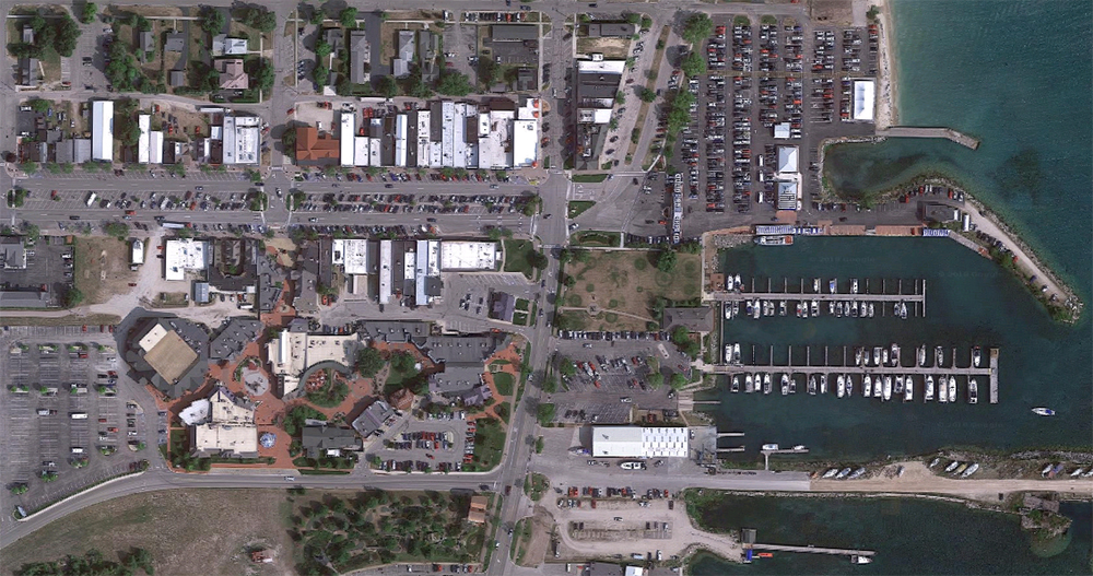
Mackinac Island, satellite view. Click for link. Map data: Ⓒ Google.
I was intrigued by Janssen's pitch. This fit snugly within the historical preservation / re-creation niche of thematic design, and the place sounded vaguely familiar. It was only in preparing notes for this post did I remember where I saw it.
As a kid growing up in the late 1970s and early 1980s, I was an avid reader. The Childcraft Encyclopedia Series was one of my many windows to the outside world via the written word. My very favorite book of the 1980 set which my sister and I shared was called Places to Know.
The rest of the books in this set are long gone, lost to moves and garage sales. But I still have this one.
Places to Know was all about exploring the planet through geographical oddities and curiosities, whether interesting natural settings or human-made places. The headline for the Mackinac City spread nearly paraphrases Mr. Janssen: NO CARS ALLOWED. The black and white photographs (probably dating to the fifties or sixties) on the spread from Places to Know above followed me around like ghosts as I explored the small downtown district on the island. But more on that a bit later.
Mackinac Island is a great example of a place with a real historical legacy that has been elevated through layers of kitsch and camp to the status of Tourist Trap.
There are resort towns like this all over the United States, and they tend to go well with bodies of water and a strong Summer Spending Season.
Conversely Mackinaw City, which we had just departed by ferry, doesn’t have the same kind of historical claim. It was built up and kitschified simply because it’s the access point to the island—which is the real enchilada, tourist-wise. The layers of historicity, remodelling, and redevelopment are similar, but there was no “original attraction” in Mackinaw City to latch onto. It’s just second banana; a gateway to another place.
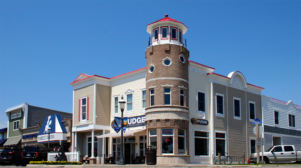
As is typical with these types of towns, Mackinac Island dials up its “historicity” in service of branding. There is contemporary signage all over, replete with Victorian-looking typography that badges certain sites as “official” and “historic.”
There are numerous buildings which, at least to my untrained eye, appear to be restored historical structures from some past era. The materials use is the most telling; the mixtures of brick work and wood, and the lack of metal framing. Also window size (smaller, before mass-produced plate glass technology).
In other instances (again, I’m no architecture historian) the buildings appear new “as old” more in the Disney theme park loose interpretation of turn of the century Victorian forms.
I have mixed feelings about this, design-wise. In some ways, the lack of Total Control like you’d see in a Disneyland-type environment—or the Mackinaw Crossings retail district I had just left behind in Mackinaw City—means that the experience is more authentic.
Not everything is clean, shiny, upkept; there is less fiberglass and plasticity and gloss.
But that same lack of central ‘design authority’ means a visual hodgepodge; a mess.
Here a block-length Western clapboard saloon lives side by side with a small domestic bungalow—a contradiction you’d be hard-pressed to find at a Disney theme park environment.
With national chains, however, at least Mackinac Island tries. Many restored “historic districts” or renovated small town Main Streets across the country provide visual standards to companies that wish to plop down next to much older structures. Here Starbucks is presented with the same Old West-style false front architecture as many other shops on the island.
You get pockets of beauty, sure—a restored house, a renovated business block.
And then you get souvenir shops selling awful cheap t-shirt designs and retail spaces crammed to the gills with tchotchkes and too much fudge and way more ice cream than you can handle. The strongest vibe I got was of Lahaina on the West Side of Maui, where I spent a lot of time growing up.
The very historic storefront, circa 1960. But the signage and facade rather suggest 1860.
That’s the real rub; the authentic “contradictions” of the urban experience—which legendary Imagineer John Hench often noted with pride were rather intentionally eliminated through the Disney design process—are, from a certain perspective, compelling. Some are also ugly as hell.
The Disneyland-esque Mackinaw Crossings development is the kind of design that many (mostly architecture critics) label tastelessly contrived. But there is a holistic vision, a single story, being executed—even if you think it’s too shiny.
Mackinac Island has no such sweeping, cohesive narrative to its structures and spaces. There are bits and pieces—Fort Mackinac which was built during the American Revolutionary War, the tradition of fishing and fudge-making, the grand Victorian hotels and rooming houses, the banning of automobiles.
What’s interesting about the island is that there’s more than one level of tourism going on here. By that I mean that Mackinac Island was a tourist town historically. The well-to-do have been vacationing here and eating fudge here and buying souvenirs here since just after the Civil War.
And Mackinac Island is also a tourist town today. The crowds it draws during the summer months these days are really only two groups: overnight guests and day visitors.
Those who stay overnight at the island’s restored hotels and Victorian bed and breakfast houses basically pay through the nose for the privilege. They are the contemporary, upmarket equivalent of the island’s traditional, 19th century tourist base.
And then you have folks like me; we come out on the ferry for the day, take a bunch of pictures, buy some food and maybe a couple t-shirts of the “I Was Here” variety and some nautical-but-nice brass bric-à-brac from Ye Olde Candle Shoppe, and get right back on the boat to the mainland. This is the downmarket group, and I include myself in it.
The odd tension between downmarket and upmarket guests is expressed well in the spaces and structures seen on Mackinac Island.
Essentially, the nice, restored, well-kept stuff is mostly on the inland side of the streets of the downtown area. Or it’s far, far further down the water’s edge, like this restored hotel.
And the rest of downtown faces (and smells strongly of) the water. Here’s one such establishment—the obligatory “Western Trading Post” hocking cheap t-shirts.
In closing this brings me back to the book I read as a child, which gave me the mental pictures I carried along with me on my visit to Mackinac Island. I didn’t remember the text, not until I examined the book recently while preparing my notes for this post. But I had a vague sense of the photographs—they were pictures of the island as a tourist town historically. No tacky t-shirt shops and shabbily dressed (average) American visitors.
Although these photos hardly have people in them, I imagined them—in my mind’s eye—in historical costume. I imagined wealthy Victorian hotel guests. And although I’m speaking of pictures in a children’s encyclopedia, this is still the language of cinematic subsumption. I was let down ever so slightly that the Mackinac Island from the pages of my virtual childhood didn’t meet the reality. These heightened expectations are something I will return to time and again.